
南淝河 topographic map
Interactive map
Click on the map to display elevation.
About this map
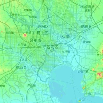
Name: 南淝河 topographic map, elevation, terrain.
Location: 南淝河, Anhui, China (31.55805 117.05963 31.98863 117.42667)
Average elevation: 85 ft
Minimum elevation: 10 ft
Maximum elevation: 846 ft
Other topographic maps
Click on a map to view its topography, its elevation and its terrain.