
Compton topographic map
Click on the map to display elevation.
About this map
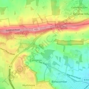
Name: Compton topographic map, elevation, terrain.
Location: Compton, Hurtmore, Guildford, Surrey, England, United Kingdom (51.20109 -0.64949 51.24034 -0.60852)
Average elevation: 292 ft
Minimum elevation: 131 ft
Maximum elevation: 502 ft
Other topographic maps
Click on a map to view its topography, its elevation and its terrain.
Cranleigh Waters or Bramley Wey
United Kingdom > England > Surrey > Guildford > Shalford
Average elevation: 171 ft