Geolocate

Kaptagat topographic map

Click on the map to display elevation.

About this map

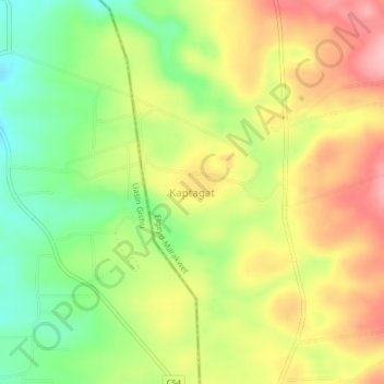
Name: Kaptagat topographic map, elevation, terrain.

Location: Kaptagat, Elgeyo-Marakwet County, Kenya (0.40898 35.46090 0.44898 35.50090)

Average elevation: 7,956 ft

Minimum elevation: 7,733 ft

Maximum elevation: 8,182 ft

Gear up for your next adventure:

🎒Trekking Poles - Sturdy poles for balance and stability on rough terrain
🩳Quick‑Dry Hiking Shorts - Comfortable and quick‑dry shorts for summer hiking
🌧️Backpack Rain Cover - Keep gear dry in wet weather
☀️Outdoor Sunscreen - High protection sunscreen for outdoor activities
😴Insulated Sleeping Pads - Compact and warm pads for high-elevation camping

As an Amazon Associate, this site earns from qualifying purchases at no extra cost to you.