
Walloon topographic map
Click on the map to display elevation.
About this map
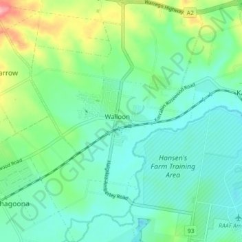
Name: Walloon topographic map, elevation, terrain.
Location: Walloon, Ipswich City, Queensland, Australia (-27.63677 152.63932 -27.57528 152.68886)
Average elevation: 164 ft
Minimum elevation: 59 ft
Maximum elevation: 469 ft
Other topographic maps
Click on a map to view its topography, its elevation and its terrain.
Flinders - Goolman Conservation Estate
Australia > Queensland > Ipswich City
Average elevation: 515 ft