Geolocate

Alba topographic map

Click on the map to display elevation.

About this map

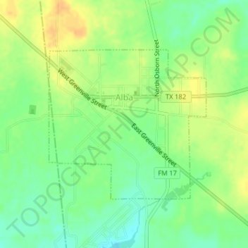
Name: Alba topographic map, elevation, terrain.

Location: Alba, Wood County, Texas, 75410, United States (32.78182 -95.64417 32.79810 -95.62380)

Average elevation: 449 ft

Minimum elevation: 397 ft

Maximum elevation: 499 ft

Wood County trails, hiking, mountain biking, running and outdoor activities

Other topographic maps

Click on a map to view its topography, its elevation and its terrain.

Concord

United States > Texas > Wood County

Average elevation: 420 ft

Holly Lake Ranch

United States > Texas > Wood County

Average elevation: 400 ft

Angler

United States > Texas > Wood County

Average elevation: 331 ft

Calvary

United States > Texas > Wood County

Average elevation: 433 ft

Gear up for your next adventure:

📖Nature Tracking Books - Learn to track wildlife and terrain
🛰️Handheld GPS Units - Professional satellite navigators for precise backcountry mapping
🖼️Topo Map Wall Art - Decorative topographic prints of famous peaks and regions
🌐World Map Poster - Decorative world maps with topographic info
🧼Biodegradable Camping Soap - Eco‑friendly soap for outdoor hygiene

As an Amazon Associate, this site earns from qualifying purchases at no extra cost to you.