
Lac Vert topographic map
Click on the map to display elevation.
About this map
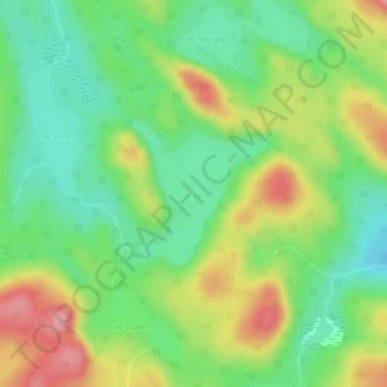
Name: Lac Vert topographic map, elevation, terrain.
Location: Lac Vert, Lac-Normand, Mékinac, Mauricie, Quebec, Canada (47.13929 -73.40804 47.14944 -73.39434)
Average elevation: 1,430 ft
Minimum elevation: 1,276 ft
Maximum elevation: 1,657 ft