
Sesfontein topographic map
Click on the map to display elevation.
About this map
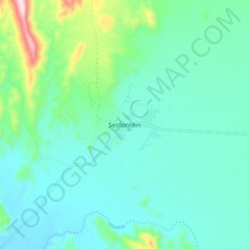
Name: Sesfontein topographic map, elevation, terrain.
Location: Sesfontein, Kunene Region, Namibia (-19.16317 13.57758 -19.08317 13.65758)
Average elevation: 1,995 ft
Minimum elevation: 1,706 ft
Maximum elevation: 3,222 ft
Other topographic maps
Click on a map to view its topography, its elevation and its terrain.