Geolocate

Rive topographic map

Click on the map to display elevation.

About this map
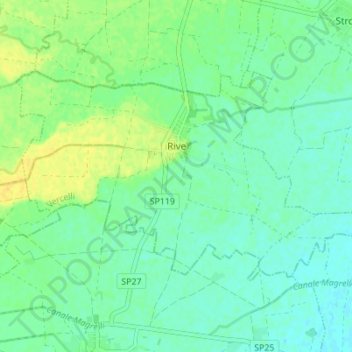
Name: Rive topographic map, elevation, terrain.

Location: Rive, Vercelli, Piemonte, Italia (45.19430 8.38620 45.22324 8.45517)

Average elevation: 397 ft

Minimum elevation: 367 ft

Maximum elevation: 443 ft

Other topographic maps

Click on a map to view its topography, its elevation and its terrain.

Rolate

Italia > Piemonte > Vercelli > Varallo > Camasco

Average elevation: 3,061 ft

Ferrera

Italia > Piemonte > Vercelli > Cravagliana

Average elevation: 3,343 ft

Roasio Santa Maria

Italia > Piemonte > Vercelli

Average elevation: 965 ft

Barattina

Italia > Piemonte > Vercelli > Varallo > Cervarolo - Villa Inferiore

Average elevation: 2,405 ft

Sant'Antonino

Italia > Piemonte > Vercelli > Saluggia

Average elevation: 617 ft

Bocchetta delle Pisse

Italia > Piemonte > Vercelli > Alagna Valsesia

Average elevation: 7,333 ft

Cesolo

Italia > Piemonte > Vercelli > Borgosesia

Average elevation: 1,499 ft

Gear up for your next adventure:

🔌Solar Panel Charger - Charge gear sustainably outdoors
🧦Hiking Socks - Comfortable socks to prevent blisters on long hikes
📻Weather Alert Radios - Stay informed of storm risks while off-the-grid
📶Satellite Messenger - Communication device off‑grid
🛡️Insect Repellent - Protection against bugs during outdoor activities

As an Amazon Associate, this site earns from qualifying purchases at no extra cost to you.