
Make a donation
Gear up for your next adventure:
As an Amazon Associate, this site earns from qualifying purchases at no extra cost to you.
Pueblo West topographic map
Click on the map to display elevation.
Make a donation
Gear up for your next adventure:
As an Amazon Associate, this site earns from qualifying purchases at no extra cost to you.
About this map
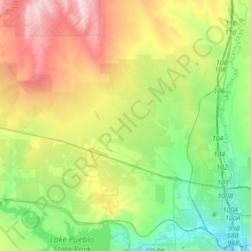
Name: Pueblo West topographic map, elevation, terrain.
Location: Pueblo West, Pueblo County, Colorado, 81007, United States (38.28002 -104.85887 38.43179 -104.61163)
Average elevation: 5,075 ft
Minimum elevation: 4,656 ft
Maximum elevation: 5,817 ft
Pueblo County trails, hiking, mountain biking, running and outdoor activities
Make a donation
Gear up for your next adventure:
As an Amazon Associate, this site earns from qualifying purchases at no extra cost to you.
Other topographic maps
Click on a map to view its topography, its elevation and its terrain.
Make a donation
Gear up for your next adventure:
As an Amazon Associate, this site earns from qualifying purchases at no extra cost to you.