Geolocate

Marsa Alam topographic map

Click on the map to display elevation.

About this map

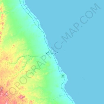
Name: Marsa Alam topographic map, elevation, terrain.

Location: Marsa Alam, Red Sea, 84721, Egypt (24.90999 34.73382 25.22999 35.05382)

Average elevation: 262 ft

Minimum elevation: -3 ft

Maximum elevation: 1,978 ft

Gear up for your next adventure:

🎒Trekking Poles - Sturdy poles for balance and stability on rough terrain
⛑️Personal Locator Beacon - Safety beacon for emergencies
🧦Hiking Socks - Comfortable socks to prevent blisters on long hikes
📶Vehicle Signal Boosters - Improve reception in rural areas while driving to trailheads
👓Polarized Sunglasses - Outdoor sunglasses for glare reduction

As an Amazon Associate, this site earns from qualifying purchases at no extra cost to you.