Geolocate

Canacona topographic map

Click on the map to display elevation.

Canacona

Canacona is located at 15°01′N 74°01′E / 15.02°N 74.02°E / 15.02; 74.02. It has an average elevation of 10 metres (32 feet). Canacona is the southernmost taluka of Goa.

Wikipedia (CC-BY-SA 3.0)

About this map

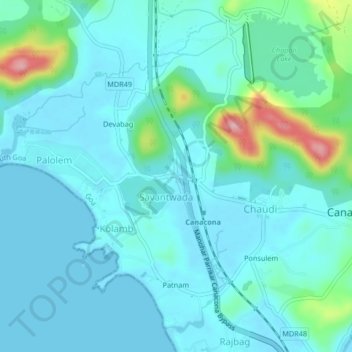
Name: Canacona topographic map, elevation, terrain.

Location: Canacona, South Goa, Goa, 403702, India (14.96691 74.01706 15.04691 74.09706)

Average elevation: 194 ft

Minimum elevation: -10 ft

Maximum elevation: 1,578 ft

Other topographic maps

Click on a map to view its topography, its elevation and its terrain.

Cola Beach

India > Goa > Canacona

Average elevation: 79 ft

Galgibaga

India > Goa > Canacona > Poingonin

Average elevation: 148 ft

Cola Beach

India > Goa > Canacona

Average elevation: 79 ft

Talpona

India > Goa > Canacona > Canacona

Average elevation: 509 ft

Butterfly Beach

India > Goa > Canacona

Average elevation: 92 ft

Gear up for your next adventure:

🔦Powerful Headlamps - Ultra-bright hands-free lighting for night navigation
🎒Trekking Poles - Sturdy poles for balance and stability on rough terrain
📶Satellite Messenger - Communication device off‑grid
🧤Tactile Hiking Gloves - Keep hands warm while operating GPS and smartphone screens
🧭Hiking Compass - Precision compass for reliable navigation in the wilderness

As an Amazon Associate, this site earns from qualifying purchases at no extra cost to you.