
连城县 topographic map
Interactive map
Click on the map to display elevation.
About this map
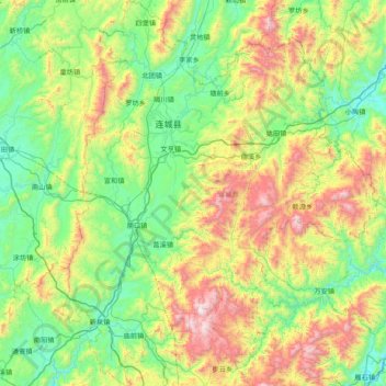
Name: 连城县 topographic map, elevation, terrain.
Location: 连城县, 龙岩市, 福建省, 中国 (25.23696 116.53752 25.93385 117.16816)
Average elevation: 2,215 ft
Minimum elevation: 725 ft
Maximum elevation: 5,837 ft
Other topographic maps
Click on a map to view its topography, its elevation and its terrain.