
Varnavas topographic map
Click on the map to display elevation.
About this map
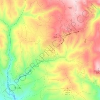
Name: Varnavas topographic map, elevation, terrain.
Average elevation: 1,496 ft
Minimum elevation: 906 ft
Maximum elevation: 1,949 ft
Other topographic maps
Click on a map to view its topography, its elevation and its terrain.
Municipality of Vari - Voula - Vouliagmeni
Greece > Attica > Regional Unit of East Attica
Average elevation: 161 ft
Kalyvia Thorikou Municipal Unit
Greece > Attica > Regional Unit of East Attica
Average elevation: 433 ft
Dioni
Greece > Attica > Regional Unit of East Attica > Pikermi Municipal Unit
Average elevation: 791 ft
Municipality of Vari - Voula - Vouliagmeni
Greece > Attica > Regional Unit of East Attica
Average elevation: 161 ft
Gerakas Municipal Unit
Greece > Attica > Regional Unit of East Attica > Gerakas Municipal Unit
Average elevation: 850 ft