Geolocate

Monte Agri topographic map

Click on the map to display elevation.

About this map

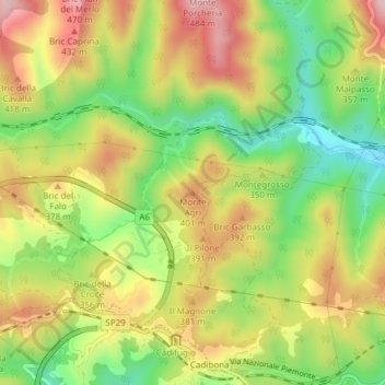
Name: Monte Agri topographic map, elevation, terrain.

Location: Monte Agri, Savona, Liguria, 17041, Italy (44.34422 8.38169 44.34432 8.38179)

Average elevation: 1,037 ft

Minimum elevation: 568 ft

Maximum elevation: 1,522 ft

Gear up for your next adventure:

🚁Photography Drones - Capture stunning aerial views of landforms and topography
☀️Outdoor Sunscreen - High protection sunscreen for outdoor activities
🛡️Bear Spray Outdoor - Protection in bear country hikes
📶Satellite Messenger - Communication device off‑grid
🔋Rechargeable Batteries - Power up your outdoor devices

As an Amazon Associate, this site earns from qualifying purchases at no extra cost to you.