
Ash Grove topographic map
Click on the map to display elevation.
About this map
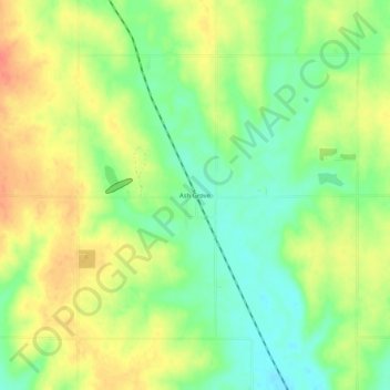
Name: Ash Grove topographic map, elevation, terrain.
Location: Ash Grove, Lincoln County, Kansas, United States (39.14140 -98.38200 39.18140 -98.34200)
Average elevation: 1,535 ft
Minimum elevation: 1,453 ft
Maximum elevation: 1,621 ft
Lincoln County trails, hiking, mountain biking, running and outdoor activities
Other topographic maps
Click on a map to view its topography, its elevation and its terrain.