
东坡傣族乡 topographic map
Interactive map
Click on the map to display elevation.
About this map
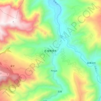
Name: 东坡傣族乡 topographic map, elevation, terrain.
Location: 东坡傣族乡, 武定县, 楚雄彝族自治州, 云南省, 中国 (25.86494 102.04367 25.94494 102.12367)
Average elevation: 5,233 ft
Minimum elevation: 3,251 ft
Maximum elevation: 8,159 ft
Other topographic maps
Click on a map to view its topography, its elevation and its terrain.