
Make a donation
Gear up for your next adventure:
As an Amazon Associate, this site earns from qualifying purchases at no extra cost to you.
Eagle Valley Reservoir topographic map
Click on the map to display elevation.
Make a donation
Gear up for your next adventure:
As an Amazon Associate, this site earns from qualifying purchases at no extra cost to you.
About this map
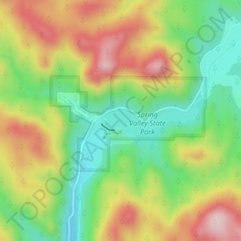
Name: Eagle Valley Reservoir topographic map, elevation, terrain.
Average elevation: 6,204 ft
Minimum elevation: 5,715 ft
Maximum elevation: 6,804 ft
Lincoln County trails, hiking, mountain biking, running and outdoor activities
Make a donation
Gear up for your next adventure:
As an Amazon Associate, this site earns from qualifying purchases at no extra cost to you.
Other topographic maps
Click on a map to view its topography, its elevation and its terrain.
Hiko
United States > Nevada > Lincoln County
The Hiko and Crystal Springs provide a large supply of water for the Hiko farms and ranches. The Hiko farming community is located in the north end of the Pahranagat Valley and lies at an elevation of 3,869 feet (1,179 m), with a ZIP code of 89017.
Average elevation: 4,045 ft
Make a donation
Gear up for your next adventure:
As an Amazon Associate, this site earns from qualifying purchases at no extra cost to you.