
Make a donation
Gear up for your next adventure:
As an Amazon Associate, this site earns from qualifying purchases at no extra cost to you.
Kamalpur topographic map
Click on the map to display elevation.
Make a donation
Gear up for your next adventure:
As an Amazon Associate, this site earns from qualifying purchases at no extra cost to you.
About this map
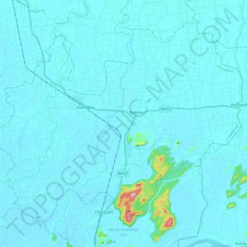
Name: Kamalpur topographic map, elevation, terrain.
Location: Kamalpur, Kamrup, Assam, India (26.25212 91.59791 26.41762 91.82193)
Average elevation: 190 ft
Minimum elevation: 148 ft
Maximum elevation: 1,050 ft
Make a donation
Gear up for your next adventure:
As an Amazon Associate, this site earns from qualifying purchases at no extra cost to you.
Other topographic maps
Click on a map to view its topography, its elevation and its terrain.
Make a donation
Gear up for your next adventure:
As an Amazon Associate, this site earns from qualifying purchases at no extra cost to you.
Make a donation
Gear up for your next adventure:
As an Amazon Associate, this site earns from qualifying purchases at no extra cost to you.
Make a donation
Gear up for your next adventure:
As an Amazon Associate, this site earns from qualifying purchases at no extra cost to you.
Dhemaji
Dhemaji is located at 27°29′N 94°35′E / 27.48°N 94.58°E / 27.48; 94.58. It has an average elevation of 91 metres (298 feet). Dhemaji is located to the north of the river Brahmaputra. To its north lies the Arunachal Himalayas. To its east lies the state, Arunachal Pradesh and to the west is…
Average elevation: 335 ft
Make a donation
Gear up for your next adventure:
As an Amazon Associate, this site earns from qualifying purchases at no extra cost to you.
Make a donation
Gear up for your next adventure:
As an Amazon Associate, this site earns from qualifying purchases at no extra cost to you.
Rongpharbi Rongbe;Diphu
India > Assam > Diphu > Rongpharbi Rongbe;Diphu
Diphu is located at 25°50′N 93°26′E / 25.83°N 93.43°E / 25.83; 93.43. It has an average elevation of 186 metres (610 feet). It is about 270 km by road and 213 km by railways from Guwahati. The town is located on a beautiful hill.
Average elevation: 630 ft
Make a donation
Gear up for your next adventure:
As an Amazon Associate, this site earns from qualifying purchases at no extra cost to you.
Make a donation
Gear up for your next adventure:
As an Amazon Associate, this site earns from qualifying purchases at no extra cost to you.
Udalguri
India > Assam > Udalguri tehsil
Odalguri is located at 26°44′43″N 92°05′46″E / 26.7452°N 92.0962°E / 26.7452; 92.0962. It has an average elevation of 180 metres (590 ft).
Average elevation: 358 ft