Geolocate

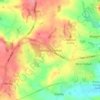
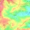
Morley topographic map

Click on the map to display elevation.

About this map

Name: Morley topographic map, elevation, terrain.

Location: Morley, Erewash, Derbyshire, East Midlands, England, United Kingdom (52.93118 -1.43427 52.98140 -1.38810)

Average elevation: 344 ft

Minimum elevation: 177 ft

Maximum elevation: 515 ft

Other topographic maps

Click on a map to view its topography, its elevation and its terrain.
Ilkeston

United Kingdom > England > Derbyshire > Erewash

Average elevation: 266 ft

Stanley Common

United Kingdom > England > Derbyshire > Erewash

Average elevation: 351 ft

Draycott

United Kingdom > England > Derbyshire > Erewash

Average elevation: 138 ft

Ockbrook

United Kingdom > England > Derbyshire > Erewash

Average elevation: 259 ft

West Hallam

United Kingdom > England > Derbyshire > Erewash

Average elevation: 299 ft

Cotmanhay

United Kingdom > England > Derbyshire > Erewash

Average elevation: 233 ft

Derby Canal

United Kingdom > England > Derbyshire > Erewash > Draycott

Average elevation: 157 ft

Long Eaton

United Kingdom > England > Derbyshire > Erewash

Average elevation: 102 ft

Stanley

United Kingdom > England > Derbyshire > Erewash

The Church gates commemorate Queen Victoria's Golden Jubilee of 1887, and the churchyard contains a memorial (erected in 2004) to the five aircrew who lost their lives when an experimental high-altitude RAF Wellington Bomber disintegrated above Stanley in 1942 following a loss of cabin pressure.

Average elevation: 328 ft
Borrowash

United Kingdom > England > Derbyshire > Erewash

Average elevation: 194 ft

Morley Smithy

United Kingdom > England > Derbyshire > Erewash > Morley

Average elevation: 371 ft

Stanley

United Kingdom > England > Derbyshire > Erewash

The Church gates commemorate Queen Victoria's Golden Jubilee of 1887, and the churchyard contains a memorial (erected in 2004) to the five aircrew who lost their lives when an experimental high-altitude RAF Wellington Bomber disintegrated above Stanley in 1942 following a loss of cabin pressure.

Average elevation: 328 ft
Ockbrook

United Kingdom > England > Derbyshire > Erewash

Average elevation: 259 ft

Borrowash

United Kingdom > England > Derbyshire > Erewash

Average elevation: 194 ft

Draycott

United Kingdom > England > Derbyshire > Erewash

Average elevation: 138 ft

Morley Smithy

United Kingdom > England > Derbyshire > Erewash > Morley

Average elevation: 371 ft

Gear up for your next adventure:

🌐World Map Poster - Decorative world maps with topographic info
🖼️Topo Map Wall Art - Decorative topographic prints of famous peaks and regions
🪶Fire Starter Kit - Reliable fire starter for survival and camping
🛰️Satellite Messengers - Emergency SOS and two-way messaging for off-grid adventures
🦶Carbon Trekking Poles - Reduce knee impact on steep descents with ultra-light poles

As an Amazon Associate, this site earns from qualifying purchases at no extra cost to you.