Geolocate

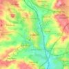
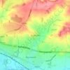
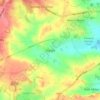
Long Eaton topographic map

Click on the map to display elevation.

About this map

Name: Long Eaton topographic map, elevation, terrain.

Location: Long Eaton, Erewash, Derbyshire, England, United Kingdom (52.88500 -1.28003 52.88670 -1.27176)

Average elevation: 102 ft

Minimum elevation: 79 ft

Maximum elevation: 223 ft

Other topographic maps

Click on a map to view its topography, its elevation and its terrain.

Long Eaton

United Kingdom > England > Derbyshire > Erewash

Average elevation: 115 ft

Ilkeston

United Kingdom > England > Derbyshire > Erewash

Average elevation: 266 ft

Little Eaton

United Kingdom > England > Derbyshire > Erewash

Average elevation: 269 ft

Sandiacre

United Kingdom > England > Derbyshire > Erewash

Average elevation: 187 ft

Stanley Common

United Kingdom > England > Derbyshire > Erewash

Average elevation: 351 ft

Breaston

United Kingdom > England > Derbyshire > Erewash

Average elevation: 131 ft

Draycott

United Kingdom > England > Derbyshire > Erewash

Average elevation: 138 ft

Ockbrook

United Kingdom > England > Derbyshire > Erewash

Average elevation: 259 ft

Risley

United Kingdom > England > Derbyshire > Erewash

Average elevation: 259 ft

West Hallam

United Kingdom > England > Derbyshire > Erewash

Average elevation: 299 ft

Cotmanhay

United Kingdom > England > Derbyshire > Erewash

Average elevation: 233 ft

Stanton by Dale

United Kingdom > England > Derbyshire > Erewash

Average elevation: 233 ft

Morley

United Kingdom > England > Derbyshire > Erewash

Average elevation: 344 ft

Dale Abbey

United Kingdom > England > Derbyshire > Erewash

Average elevation: 292 ft

Sawley

United Kingdom > England > Derbyshire > Erewash

Average elevation: 105 ft

Stanley

United Kingdom > England > Derbyshire > Erewash

The Church gates commemorate Queen Victoria's Golden Jubilee of 1887, and the churchyard contains a memorial (erected in 2004) to the five aircrew who lost their lives when an experimental high-altitude RAF Wellington Bomber disintegrated above Stanley in 1942 following a loss of cabin pressure.

Average elevation: 328 ft

Ilkeston

United Kingdom > England > Derbyshire > Erewash

Average elevation: 236 ft

Borrowash

United Kingdom > England > Derbyshire > Erewash

Average elevation: 194 ft

Morley Smithy

United Kingdom > England > Derbyshire > Erewash > Morley

Average elevation: 371 ft

Breadsall

United Kingdom > England > Derbyshire > Erewash

Average elevation: 285 ft

River Erewash

United Kingdom > England > Derbyshire > Erewash

The approximate meaning of the name is not in doubt, but there is room for debate about the precise derivation and its connotations. Brewer gives the commonly accepted explanation that it comes from the Old English words irre ("wandering") and wisce ("wet meadow"). This is accepted by Kenneth Cameron, a…

Average elevation: 285 ft

Ilkeston

United Kingdom > England > Derbyshire > Erewash

Average elevation: 236 ft

Sawley

United Kingdom > England > Derbyshire > Erewash

Average elevation: 105 ft

Stanley

United Kingdom > England > Derbyshire > Erewash

The Church gates commemorate Queen Victoria's Golden Jubilee of 1887, and the churchyard contains a memorial (erected in 2004) to the five aircrew who lost their lives when an experimental high-altitude RAF Wellington Bomber disintegrated above Stanley in 1942 following a loss of cabin pressure.

Average elevation: 328 ft
Long Eaton

United Kingdom > England > Derbyshire > Erewash

Average elevation: 115 ft

Long Eaton

United Kingdom > England > Derbyshire > Erewash

Average elevation: 115 ft

Ockbrook

United Kingdom > England > Derbyshire > Erewash

Average elevation: 259 ft

Borrowash

United Kingdom > England > Derbyshire > Erewash

Average elevation: 194 ft

Draycott

United Kingdom > England > Derbyshire > Erewash

Average elevation: 138 ft

Long Eaton

United Kingdom > England > Derbyshire > Erewash

Average elevation: 115 ft

Ilkeston

United Kingdom > England > Derbyshire > Erewash

Average elevation: 236 ft

Morley Smithy

United Kingdom > England > Derbyshire > Erewash > Morley

Average elevation: 371 ft

Gear up for your next adventure:

🧴Hand Sanitizer - Keep hands clean while hiking
🛡️Insect Repellent - Protection against bugs during outdoor activities
👟Men's Trail Runners - Lightweight footwear for fast-paced exploration and light hiking
🎒Waterproof Dry Bags - Keep your electronics and maps dry inside your pack
📡GPS Antenna Upgrade - Enhance GPS reception in remote terrain

As an Amazon Associate, this site earns from qualifying purchases at no extra cost to you.