
Make a donation
Gear up for your next adventure:
As an Amazon Associate, this site earns from qualifying purchases at no extra cost to you.
Stirling topographic map
Click on the map to display elevation.
Make a donation
Gear up for your next adventure:
As an Amazon Associate, this site earns from qualifying purchases at no extra cost to you.
Stirling
Many deciduous trees, particularly the maple, elm, oak and ash trees, have been imported from Europe and North America. These trees flourish in Stirling's wet and mild to cool climate and are a popular tourist attraction in the autumn months (April–May), bringing rich and vibrant autumn leaf colour to the town. This activity is known as "leaf peeping". Some Australian cities are too warm (even in the autumn and winter months) to accommodate and produce maple trees, but some temperate regions along the eastern coast and towns at higher altitudes flourish in colour during autumn, rivalling those in North America, Europe and Japan.
Make a donation
Gear up for your next adventure:
As an Amazon Associate, this site earns from qualifying purchases at no extra cost to you.
About this map
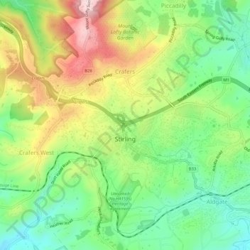
Name: Stirling topographic map, elevation, terrain.
Average elevation: 1,654 ft
Minimum elevation: 1,240 ft
Maximum elevation: 2,251 ft
Make a donation
Gear up for your next adventure:
As an Amazon Associate, this site earns from qualifying purchases at no extra cost to you.
Other topographic maps
Click on a map to view its topography, its elevation and its terrain.
Adelaide
Australia > South Australia > Adelaide
Adelaide is north of the Fleurieu Peninsula, on the Adelaide Plains between the Gulf St Vincent and the low-lying Mount Lofty Ranges. The city stretches 20 km (12 mi) from the coast to the foothills, and 90 km (56 mi) from Gawler at its northern extent to Sellicks Beach in the south. According to the Regional…
Average elevation: 486 ft
Blue Lake
Australia > South Australia > Mount Gambier
Each November, the lake turns to a deep turquoise colour, gradually returning to a duller blue colour in late February to March. The exact cause of this phenomenon is still a matter of conjecture, but likely it involves the warming of the surface layers of the lake during the summer to around 20 °C (68 °F),…
Average elevation: 174 ft
Mount Sunderland
Australia > South Australia > Pastoral Unincorporated Area
Average elevation: 2,238 ft
Make a donation
Gear up for your next adventure:
As an Amazon Associate, this site earns from qualifying purchases at no extra cost to you.
Western River (South Branch)
Australia > South Australia > Kangaroo Island Council
Average elevation: 696 ft
Make a donation
Gear up for your next adventure:
As an Amazon Associate, this site earns from qualifying purchases at no extra cost to you.
Gawler
Australia > South Australia > Gawler
Gawler is the oldest country town on the Australian mainland in the state of South Australia. It was named after the second Governor (British Vice-Regal representative) of the colony of South Australia, George Gawler. It is about 40–44 km (25–27 mi) north of the centre of the state capital, Adelaide, and…
Average elevation: 466 ft
Make a donation
Gear up for your next adventure:
As an Amazon Associate, this site earns from qualifying purchases at no extra cost to you.
Moomba Gas and Oil Field
Australia > South Australia > Pastoral Unincorporated Area > Moomba Gas and Oil Field
Average elevation: 118 ft
Olympic Dam
Australia > South Australia > Municipal Council of Roxby Downs > Olympic Dam
Average elevation: 341 ft
Black Gap
Australia > South Australia > The Flinders Ranges Council > Hawker
Average elevation: 1,608 ft
Adelaide (Sellicks Hill) Weather Radar
Australia > South Australia > City of Onkaparinga > Adelaide
Average elevation: 955 ft
Make a donation
Gear up for your next adventure:
As an Amazon Associate, this site earns from qualifying purchases at no extra cost to you.
Liguanea Island
Liguanea Island is an uninhabited granite island in the Australian state of South Australia located 3.7 km south of Cape Carnot at the southern, central point of Eyre Peninsula. It is approximately 2.7 km long, 180 ha in size its elevation above sea level is estimated to be 43 metres.[1] It is approximately 35…
Average elevation: 13 ft