
Make a donation
Gear up for your next adventure:
As an Amazon Associate, this site earns from qualifying purchases at no extra cost to you.
Kyber Pass topographic map
Click on the map to display elevation.
Make a donation
Gear up for your next adventure:
As an Amazon Associate, this site earns from qualifying purchases at no extra cost to you.
About this map
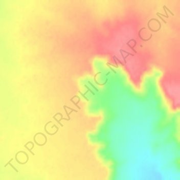
Name: Kyber Pass topographic map, elevation, terrain.
Average elevation: 906 ft
Minimum elevation: 748 ft
Maximum elevation: 1,001 ft
Make a donation
Gear up for your next adventure:
As an Amazon Associate, this site earns from qualifying purchases at no extra cost to you.
Other topographic maps
Click on a map to view its topography, its elevation and its terrain.
Munga-Thirri—Simpson Desert National Park
Australia > South Australia > Pastoral Unincorporated Area
Average elevation: 135 ft
Oodnadatta
Australia > South Australia > Pastoral Unincorporated Area
Oodnadatta is a small, remote outback town and locality in the Australian state of South Australia, located 1043 kilometres (648 miles) north-north-west of the state capital of Adelaide by road or 873 km (542 mi) direct, at an altitude of 112 metres (367 feet). The unsealed Oodnadatta Track, an outback road…
Average elevation: 427 ft
Make a donation
Gear up for your next adventure:
As an Amazon Associate, this site earns from qualifying purchases at no extra cost to you.