Geolocate

Ash topographic map

Click on the map to display elevation.

About this map

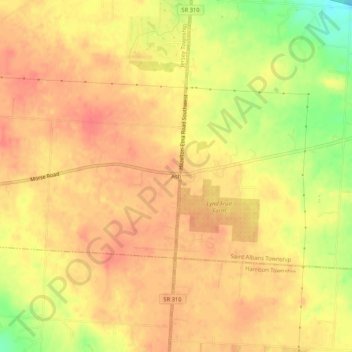
Name: Ash topographic map, elevation, terrain.

Location: Ash, Jersey Township, Licking County, Ohio, United States (40.03534 -82.68906 40.07534 -82.64906)

Average elevation: 1,204 ft

Minimum elevation: 1,073 ft

Maximum elevation: 1,260 ft

Licking County trails, hiking, mountain biking, running and outdoor activities

Other topographic maps

Click on a map to view its topography, its elevation and its terrain.

Newark

United States > Ohio > Licking County

Average elevation: 938 ft

Granville

United States > Ohio > Licking County

Average elevation: 1,027 ft

Buckeye Lake

United States > Ohio > Licking County

Average elevation: 886 ft

Utica

United States > Ohio > Licking County

Average elevation: 1,020 ft

Harbor Hills

United States > Ohio > Licking County

Average elevation: 928 ft

Utica

United States > Ohio > Licking County

Average elevation: 1,020 ft

Hebron

United States > Ohio > Licking County

Average elevation: 899 ft

Heath

United States > Ohio > Licking County

Average elevation: 922 ft

Johnstown

United States > Ohio > Licking County

Average elevation: 1,122 ft

Monroe Township

United States > Ohio > Licking County

Average elevation: 1,132 ft

Hanover

United States > Ohio > Licking County

Average elevation: 869 ft

Pataskala

United States > Ohio > Licking County

Average elevation: 1,089 ft

Raccoon Creek

United States > Ohio > Licking County > Granville

Average elevation: 1,053 ft

Johnstown

United States > Ohio > Licking County

Average elevation: 1,122 ft

Mary Ann Township

United States > Ohio > Licking County

Average elevation: 994 ft

Granville Township

United States > Ohio > Licking County

Average elevation: 1,040 ft

Newark

United States > Ohio > Licking County

Average elevation: 938 ft

Granville Township

United States > Ohio > Licking County

Average elevation: 1,040 ft

Granville

United States > Ohio > Licking County

Average elevation: 1,027 ft

Hartford Township

United States > Ohio > Licking County

Average elevation: 1,155 ft

Newark

United States > Ohio > Licking County

Average elevation: 938 ft

Buckeye Lake

United States > Ohio > Licking County > Buckeye Lake

Average elevation: 886 ft

Gear up for your next adventure:

🖼️Topo Map Wall Art - Decorative topographic prints of famous peaks and regions
🏔️Mountain Trail Maps - High‑detail maps for popular peaks
👟Trail Running Shoes - Lightweight shoes for trail runners
🪶Trail Camera - Capture wildlife on your hikes
🔭Telescopic Hiking Pole - Adjustable pole for hiking stability

As an Amazon Associate, this site earns from qualifying purchases at no extra cost to you.