Geolocate

Maynard topographic map

Click on the map to display elevation.

About this map

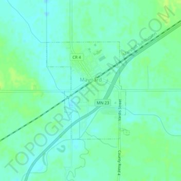
Name: Maynard topographic map, elevation, terrain.

Location: Maynard, Chippewa County, Minnesota, United States (44.89797 -95.47821 44.91252 -95.46079)

Average elevation: 1,033 ft

Minimum elevation: 1,014 ft

Maximum elevation: 1,053 ft

Chippewa County trails, hiking, mountain biking, running and outdoor activities

Other topographic maps

Click on a map to view its topography, its elevation and its terrain.

Asbury

United States > Minnesota > Chippewa County

Average elevation: 1,037 ft

Gear up for your next adventure:

📷Action Camera - Capture your outdoor adventures in HD
🧥Men's Rain Shells - Premium waterproof and breathable jackets for mountain weather
📱Heavy-Duty Phone Cases - Drop-proof and waterproof protection for outdoor navigation
🧭Orienteering Set - Complete compass and map reading kit
🩹Survival Bandages - High‑quality bandages for emergencies

As an Amazon Associate, this site earns from qualifying purchases at no extra cost to you.