
Make a donation
Gear up for your next adventure:
As an Amazon Associate, this site earns from qualifying purchases at no extra cost to you.
Laukiz topographic map
Click on the map to display elevation.
Make a donation
Gear up for your next adventure:
As an Amazon Associate, this site earns from qualifying purchases at no extra cost to you.
About this map
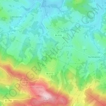
Name: Laukiz topographic map, elevation, terrain.
Location: Laukiz, Andraka, Vizcaya, País Vasco, 48620, España (43.33435 -2.93907 43.36507 -2.89096)
Average elevation: 315 ft
Minimum elevation: 7 ft
Maximum elevation: 961 ft
Make a donation
Gear up for your next adventure:
As an Amazon Associate, this site earns from qualifying purchases at no extra cost to you.
Other topographic maps
Click on a map to view its topography, its elevation and its terrain.
Valle de Trápaga
España > País Vasco > Andraka > Valle de Trápaga > Valle de Trápaga
Average elevation: 538 ft
Make a donation
Gear up for your next adventure:
As an Amazon Associate, this site earns from qualifying purchases at no extra cost to you.