Geolocate

Edmonton topographic map

Click on the map to display elevation.

About this map

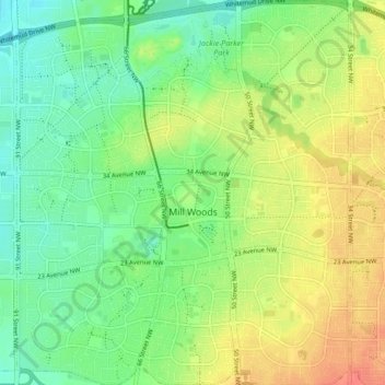
Name: Edmonton topographic map, elevation, terrain.

Location: Mill Woods, Edmonton, Alberta, Canada (53.43772 -113.46684 53.48769 -113.39361)

Average elevation: 2,290 ft

Minimum elevation: 2,221 ft

Maximum elevation: 2,379 ft

Other topographic maps

Click on a map to view its topography, its elevation and its terrain.

landslide

Canada > Alberta > Edmonton

Average elevation: 2,192 ft

William Hawrelak Park

Canada > Alberta > Edmonton

Average elevation: 2,129 ft

Horseshoe Lake

Canada > Alberta > Edmonton

Average elevation: 2,231 ft

Ormsby Park

Canada > Alberta > Edmonton

Average elevation: 2,257 ft

Gear up for your next adventure:

🪶Trail Camera - Capture wildlife on your hikes
🧯Emergency Survival Kit - All‑in‑one survival essentials for the backcountry
🚪Portable Camp Chair - Foldable chair for comfort at camp
🦟Ultrasonic Repellers - Create a bug-free zone at your camp or rest stop
🎒Hydration Pack - Hands‑free water reservoir for long hikes

As an Amazon Associate, this site earns from qualifying purchases at no extra cost to you.