Geolocate

Torna topographic map

Interactive map

Click on the map to display elevation.

About this map

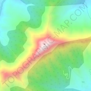
Name: Torna topographic map, elevation, terrain.

Location: Torna, Velhe, Maharashtra, 412212, India (18.27567 73.62259 18.27577 73.62269)

Average elevation: 3,274 ft

Minimum elevation: 2,438 ft

Maximum elevation: 4,600 ft

Other topographic maps

Click on a map to view its topography, its elevation and its terrain.

Torna Fort

India > Maharashtra > Velhe

Torna Fort, Rajgad - Torna trail, Velhe, Pune District, Maharashtra, 412212, India

Average elevation: 3,323 ft

Bhordi

India > Maharashtra > Velhe

Bhordi, Velhe, Pune, Maharashtra, India

Average elevation: 2,415 ft

Varasgaon Dam

India > Maharashtra > Velhe > Kuran Budruk

Varasgaon Dam, Kuran Budruk, Velhe, Maharashtra, India

Average elevation: 2,070 ft

Panshet Dam

India > Maharashtra > Velhe > Kuran Budruk

Panshet Dam, Kuran Budruk, Velhe, Maharashtra, India

Average elevation: 2,077 ft

Kondhawale

India > Maharashtra > Velhe > Kondhawale

Kondhawale, Velhe, Pune District, Maharashtra, 412212, India

Average elevation: 2,526 ft

Panshet

India > Maharashtra > Velhe > Mangaon

Panshet, Mangaon, Velhe, Maharashtra, India

Average elevation: 2,543 ft