Geolocate

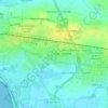
17440 topographic map

Click on the map to display elevation.

About this map

Name: 17440 topographic map, elevation, terrain.

Location: 17440, Aytré, La Rochelle, Charente-Maritime, Nouvelle-Aquitaine, France métropolitaine, France (46.13108 -1.11480 46.13118 -1.11470)

Average elevation: 23 ft

Minimum elevation: -7 ft

Maximum elevation: 66 ft

Other topographic maps

Click on a map to view its topography, its elevation and its terrain.

Gear up for your next adventure:

🪶Compact Camp Shovel - Folding shovel for campsite tasks
👟Men's Trail Runners - Lightweight footwear for fast-paced exploration and light hiking
🚪Portable Camp Chair - Foldable chair for comfort at camp
🪶Camping Sleeping Pad - Comfortable sleeping pad for backpacking
⌚GPS Sports Watch - GPS watch for running, hiking and training

As an Amazon Associate, this site earns from qualifying purchases at no extra cost to you.