Geolocate

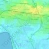
Les Caves topographic map

Click on the map to display elevation.

About this map

Name: Les Caves topographic map, elevation, terrain.

Location: Les Caves, Aytré, La Rochelle, Charente-Maritime, Nouvelle-Aquitaine, France métropolitaine, 17440, France (46.11512 -1.14816 46.15512 -1.10816)

Average elevation: 16 ft

Minimum elevation: -10 ft

Maximum elevation: 66 ft

Other topographic maps

Click on a map to view its topography, its elevation and its terrain.
17440

France > Nouvelle-Aquitaine > Charente-Maritime > Aytré

Average elevation: 23 ft

Gear up for your next adventure:

🧭Compass with Lanyard - Easy‑carry compass for navigation
🔦LED Headlamp - Bright and durable LED headlamp for night navigation
📚USA Hiking Guide Books - Top trail guides and map books
🛡️Insect Repellent - Protection against bugs during outdoor activities
🥘Titanium Cookware - Durable, featherlight pots and pans for backpacking

As an Amazon Associate, this site earns from qualifying purchases at no extra cost to you.