Geolocate

Grad Trilj topographic map

Click on the map to display elevation.

About this map

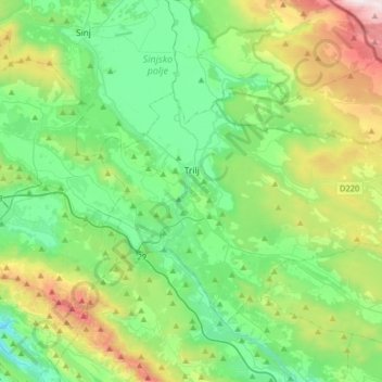
Name: Grad Trilj topographic map, elevation, terrain.

Location: Grad Trilj, Split-Dalmatia County, Croatia (43.52254 16.65049 43.68565 16.97617)

Average elevation: 1,745 ft

Minimum elevation: 203 ft

Maximum elevation: 5,873 ft

Gear up for your next adventure:

👖Convertible Hiking Pants - Versatile zip-off pants for changing altitudes and temperatures
🩹Survival Bandages - High‑quality bandages for emergencies
🧭Orienteering Set - Complete compass and map reading kit
🔊Portable Camp Speaker - Music and alerts at camp
👓Polarized Sunglasses - Outdoor sunglasses for glare reduction

As an Amazon Associate, this site earns from qualifying purchases at no extra cost to you.