
Rio Intag topographic map
Interactive map
Click on the map to display elevation.
About this map
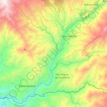
Name: Rio Intag topographic map, elevation, terrain.
Location: Rio Intag, Cotacachi, Imbabura, Ecuador (0.20660 -78.67091 0.35194 -78.51582)
Average elevation: 5,512 ft
Minimum elevation: 2,713 ft
Maximum elevation: 9,432 ft
Other topographic maps
Click on a map to view its topography, its elevation and its terrain.
Río Amarillo
Río Amarillo, San Miguel de Urcuquí, Imbabura, Ecuador
Average elevation: 3,907 ft