
Thank you for supporting this site ❤️
Make a donation
Make a donation
Gear up for your next adventure:
As an Amazon Associate, this site earns from qualifying purchases at no extra cost to you.
Repentigny topographic map
Click on the map to display elevation.
Thank you for supporting this site ❤️
Make a donation
Make a donation
Gear up for your next adventure:
As an Amazon Associate, this site earns from qualifying purchases at no extra cost to you.
About this map
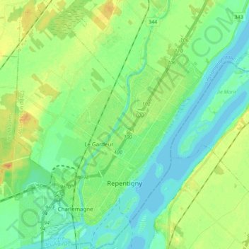
Name: Repentigny topographic map, elevation, terrain.
Location: Repentigny, L'Assomption (MRC), Lanaudière, Quebec, Canada (45.70152 -73.52800 45.81915 -73.39352)
Average elevation: 46 ft
Minimum elevation: 10 ft
Maximum elevation: 115 ft
Thank you for supporting this site ❤️
Make a donation
Make a donation
Gear up for your next adventure:
As an Amazon Associate, this site earns from qualifying purchases at no extra cost to you.