
Make a donation
Gear up for your next adventure:
As an Amazon Associate, this site earns from qualifying purchases at no extra cost to you.
Lake Kamyslybas topographic map
Click on the map to display elevation.
Make a donation
Gear up for your next adventure:
As an Amazon Associate, this site earns from qualifying purchases at no extra cost to you.
Lake Kamyslybas
Lake Kamyslybas (Kazakh: Қамыстыбас, Qamystybas) is a large saltwater lake in the Kyzylorda Region, Kazakhstan. It has an area of 176 km2, although the water level in the lake often fluctuates. It has a maximum depth of 10 meters with a coastline 116 km long at an elevation of 58 meters above sea level. It is the largest body of water in the Kamyslybas lake system. It lies in the northern part of Syr Darya's delta, to which it is connected by a canal, and the water level in the lake is affected by fluctuations on the quantity of water from the Syr-Darya. Its salinity can fluctuate significantly, sometimes reaching the point of becoming brine. Lake Kamyslybas is used as a fishery.
Make a donation
Gear up for your next adventure:
As an Amazon Associate, this site earns from qualifying purchases at no extra cost to you.
About this map
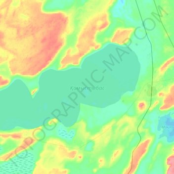
Name: Lake Kamyslybas topographic map, elevation, terrain.
Location: Lake Kamyslybas, Aral District, Kyzylorda Region, Kazakhstan (46.14397 61.61319 46.25506 61.93450)
Average elevation: 236 ft
Minimum elevation: 164 ft
Maximum elevation: 397 ft
Make a donation
Gear up for your next adventure:
As an Amazon Associate, this site earns from qualifying purchases at no extra cost to you.
Other topographic maps
Click on a map to view its topography, its elevation and its terrain.