Geolocate

Shomare topographic map

Click on the map to display elevation.

About this map

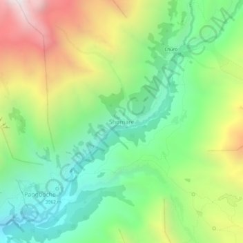
Name: Shomare topographic map, elevation, terrain.

Location: Shomare, Khumbupasanglahmu, Solukhumbu, Koshi Province, Nepal (27.84774 86.78539 27.88774 86.82539)

Average elevation: 14,511 ft

Minimum elevation: 12,425 ft

Maximum elevation: 17,966 ft

Other topographic maps

Click on a map to view its topography, its elevation and its terrain.

Likhupike

Nepal > Koshi Province > Solukhumbu

Average elevation: 9,039 ft

Sotang

Nepal > Koshi Province > Solukhumbu

Average elevation: 7,129 ft

West Ridge

Nepal > Koshi Province > Solukhumbu

Average elevation: 23,081 ft

Khumbupasanglahmu-05

Nepal > Koshi Province > Solukhumbu

Average elevation: 17,165 ft

Gear up for your next adventure:

🥇GPS Hiking Watch - Multi‑sport GPS watch with navigation and trail tracking
🎒Trail Energy Bars - High‑calorie bars for hiking energy
🗺️NatGeo Topo Maps - High-quality waterproof printed topographic maps of US Parks
📻Weather Alert Radios - Stay informed of storm risks while off-the-grid
👓Polarized Sunglasses - Outdoor sunglasses for glare reduction

As an Amazon Associate, this site earns from qualifying purchases at no extra cost to you.