Geolocate

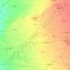
Mohali topographic map

Click on the map to display elevation.

About this map

Name: Mohali topographic map, elevation, terrain.

Location: Mohali, Sector 56, Sector 57, S.A.S. Nagar Tahisl(Mohali), Sahibzada Ajit Singh Nagar, Punjab, 190039, India (30.72488 76.70380 30.74488 76.72380)

Average elevation: 1,070 ft

Minimum elevation: 1,040 ft

Maximum elevation: 1,102 ft

Other topographic maps

Click on a map to view its topography, its elevation and its terrain.
Gidderbaha Tahsil

India > Punjab

Average elevation: 656 ft

Malerkotla

India > Punjab

Average elevation: 814 ft

Firozpur

India > Punjab

Average elevation: 666 ft

Kurar

India > Punjab > Barnala Tahsil

Average elevation: 781 ft

Sangrur

India > Punjab

Average elevation: 768 ft

Fazilka District

India > Punjab

Average elevation: 604 ft

Jallianwala Bagh

India > Punjab > Amritsar I Tahsil > Amritsar

Average elevation: 768 ft

Jalandhar II Tahsil

India > Punjab

Average elevation: 774 ft

Bathinda Tahsil

India > Punjab

Average elevation: 682 ft

Park 10 in C-Block of Aerocity

India > Punjab > Rurka

Average elevation: 1,001 ft

Jagraon Tahsil

India > Punjab > Jagraon Tahsil

Average elevation: 768 ft

Faridkot

India > Punjab

Average elevation: 676 ft

Muktsar

India > Punjab

Average elevation: 643 ft

Kapurthala

India > Punjab

Average elevation: 761 ft

Barnala

India > Punjab

Average elevation: 751 ft

Gear up for your next adventure:

⌚Solar GPS Watches - Advanced multisport watches with built-in topographic maps
🦟Ultrasonic Repellers - Create a bug-free zone at your camp or rest stop
☕Camping Coffee Makers - Enjoy premium coffee at the summit or campsite
💧Water Filtration Bottles - Safely drink from streams and lakes while exploring
🧣Merino Neck Gaiters - Multi-functional headwear for wind and sun protection

As an Amazon Associate, this site earns from qualifying purchases at no extra cost to you.