
Oro Valley topographic map
Click on the map to display elevation.
About this map
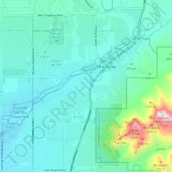
Name: Oro Valley topographic map, elevation, terrain.
Location: Oro Valley, Pima County, Arizona, 85737, United States (32.35091 -111.00649 32.43091 -110.92649)
Average elevation: 2,867 ft
Minimum elevation: 2,343 ft
Maximum elevation: 5,646 ft
Pima County trails, hiking, mountain biking, running and outdoor activities
Other topographic maps
Click on a map to view its topography, its elevation and its terrain.