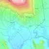
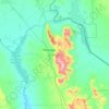
Lake Chala topographic map
Click on the map to display elevation.
Lake Chala
Lake Chala's average annual rainfall is about 565 millimetres (22.2 in). The lake surface has an average annual evaporation of near 1,735 millimetres (68.3 in). Approximately 80 percent of the lake's inflow comes from groundwater, which is derived mostly from rainfall in the montane forest zone of Mount Kilimanjaro at an elevation of 1,800 to 2,800 metres (5,900 to 9,200 ft). It takes about 3 months for groundwater to reach the lake. The groundwater flowed into the lake at an estimated annual volume of 8,390,000 cubic metres (296,000,000 cu ft) from 1964 through 1977.
About this map

Name: Lake Chala topographic map, elevation, terrain.
Location: Lake Chala, Rombo, Kilimanjaro, Northern Zone, Tanzania (-3.32718 37.68784 -3.30780 37.71228)
Average elevation: 2,953 ft
Minimum elevation: 2,772 ft
Maximum elevation: 3,547 ft
Other topographic maps
Click on a map to view its topography, its elevation and its terrain.



Kibo
The mountain was incorporated into Kilimanjaro National Park in 1973. As one of the Seven Summits, Kilimanjaro is a major hiking and climbing destination. There are seven established routes to Uhuru Peak, the mountain's highest point. Although not as technically challenging as similar mountains, the prominence…
Average elevation: 18,583 ft
Moshi
Moshi's lower altitude and drier climate mean that the main crops grown on the higher slopes of Mt Kilimanjaro, coffee and bananas, do not thrive there. The surrounding areas in Moshi district are known for extensive farms of maize and beans, grown once per year during the long rainy season (known as "masika"…
Average elevation: 3,638 ft
Moshi
Moshi's lower altitude and drier climate mean that the main crops grown on the higher slopes of Mt Kilimanjaro, coffee and bananas, do not thrive there. The surrounding areas in Moshi district are known for extensive farms of maize and beans, grown once per year during the long rainy season (known as "masika"…
Average elevation: 3,638 ft





Moshi
Moshi's lower altitude and dry climate mean that the main crops grown on the higher slopes of Mount Kilimanjaro, coffee and bananas, do not thrive there. The surrounding areas in Moshi district are known for extensive farms of maize and beans, grown once per year during the long rainy season (known as "masika"…
Average elevation: 3,638 ft