Geolocate

Shiroda topographic map

Click on the map to display elevation.

About this map

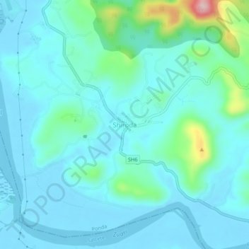
Name: Shiroda topographic map, elevation, terrain.

Location: Shiroda, Ponda, South Goa, Goa, 403103, India (15.30041 74.00944 15.34041 74.04944)

Average elevation: 108 ft

Minimum elevation: -13 ft

Maximum elevation: 715 ft

Other topographic maps

Click on a map to view its topography, its elevation and its terrain.

Ponda

India > Goa > Ponda

Average elevation: 203 ft

Gear up for your next adventure:

🌐World Map Poster - Decorative world maps with topographic info
🗺️Topographic Maps - Detailed topo maps for hiking, exploring and outdoor navigation
Backpacking Tent - Lightweight and durable tent for multi‑day hikes
🧭Map Reading Tools - Tools and kits for map navigation
🔋Rechargeable Batteries - Power up your outdoor devices

As an Amazon Associate, this site earns from qualifying purchases at no extra cost to you.