
Rush topographic map
Click on the map to display elevation.
About this map
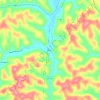
Name: Rush topographic map, elevation, terrain.
Location: Rush, Boyd County, Kentucky, 41168, United States (38.31536 -82.80155 38.35536 -82.76155)
Average elevation: 801 ft
Minimum elevation: 617 ft
Maximum elevation: 984 ft
Boyd County trails, hiking, mountain biking, running and outdoor activities
Other topographic maps
Click on a map to view its topography, its elevation and its terrain.
Westwood
United States > Kentucky > Boyd County > Fairview
Westwood is a census-designated place in Boyd County, Kentucky, United States. The population was 4,387 at the 2020 census. A suburb of Ashland, the two areas are closely affiliated, sharing a ZIP code and bus system. Westwood is located on a flat to hilly elevation just west of the Ohio River. The flat…
Average elevation: 630 ft