Geolocate

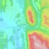
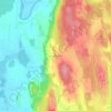
Ripton topographic map

Click on the map to display elevation.

About this map
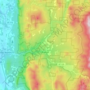
Name: Ripton topographic map, elevation, terrain.

Location: Ripton, Addison County, Vermont, 05766, United States (43.92197 -73.06332 44.04501 -72.90591)

Average elevation: 1,444 ft

Minimum elevation: 364 ft

Maximum elevation: 3,255 ft

Addison County trails, hiking, mountain biking, running and outdoor activities

Other topographic maps

Click on a map to view its topography, its elevation and its terrain.
Bristol

United States > Vermont > Addison County > Bristol > Bristol

Average elevation: 876 ft

South Mountain

United States > Vermont > Addison County > Bristol

Average elevation: 1,939 ft

Richville

United States > Vermont > Addison County > Shoreham

Average elevation: 322 ft

South Lincoln

United States > Vermont > Addison County > Lincoln

Average elevation: 1,457 ft

Bread Loaf

United States > Vermont > Addison County > Ripton

Average elevation: 1,631 ft

Chimney Point

United States > Vermont > Addison County > Addison

Average elevation: 105 ft

Gear up for your next adventure:

🔌USB Car Charger - Car charger for on‑the‑go power needs
🌡️Handheld Weather Meters - Measure wind, temp, and pressure for safe mountain travel
🥘Titanium Cookware - Durable, featherlight pots and pans for backpacking
🧦Merino Wool Socks - Moisture-wicking, blister-preventing socks for long treks
🥇GPS Hiking Watch - Multi‑sport GPS watch with navigation and trail tracking

As an Amazon Associate, this site earns from qualifying purchases at no extra cost to you.