Geolocate

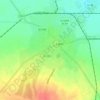
Tasnad topographic map

Click on the map to display elevation.

About this map

Name: Tasnad topographic map, elevation, terrain.

Location: Tasnad, Satu Mare, Romania (47.41336 22.53128 47.55486 22.69060)

Average elevation: 531 ft

Minimum elevation: 384 ft

Maximum elevation: 951 ft

Other topographic maps

Click on a map to view its topography, its elevation and its terrain.

Corund

Romania > Satu Mare

Average elevation: 689 ft

Lelei

Romania > Satu Mare

Average elevation: 827 ft

Carei

Romania > Satu Mare

Average elevation: 446 ft

Petea

Romania > Satu Mare

Average elevation: 397 ft

Giurtelecu Hododului

Romania > Satu Mare

Average elevation: 784 ft

Cean

Romania > Satu Mare

Average elevation: 610 ft

Sătmărel

Romania > Satu Mare > Satu Mare

Average elevation: 397 ft

Decebal

Romania > Satu Mare

Average elevation: 394 ft

Gear up for your next adventure:

🛠️Outdoor Gear Repair Kit - Essential tools to fix gear on the trail
📷Action Cameras - Rugged cameras to document your journeys across rugged terrain
🌡️Handheld Weather Meters - Measure wind, temp, and pressure for safe mountain travel
📱Heavy-Duty Phone Cases - Drop-proof and waterproof protection for outdoor navigation
🔥Plasma Lighters - Windproof lighters that work in any weather condition

As an Amazon Associate, this site earns from qualifying purchases at no extra cost to you.