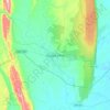
Santa María del Río topographic map
Click on the map to display elevation.
Santa María del Río
Santa Maria del Rio is located in the center of the southern part of the San Luis Potosí, at an average altitude of 1,710 meters above sea level. The municipality is bordered on the north by the municipalities of Zaragoza, San Nicolás Tolentino and Ciudad Fernández, to the east is San Luis Potosí, to the south is Tierra Nueva and to the west is Villa de Reyes.
About this map
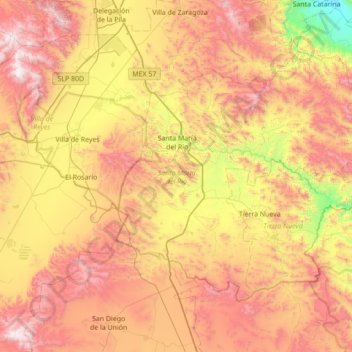
Name: Santa María del Río topographic map, elevation, terrain.
Location: Santa María del Río, San Luis Potosí, Mexico (21.50579 -100.85760 21.96455 -100.16283)
Average elevation: 6,594 ft
Minimum elevation: 3,848 ft
Maximum elevation: 9,436 ft
Other topographic maps
Click on a map to view its topography, its elevation and its terrain.
Real de Catorce
Mexico > San Luis Potosi > Catorce
Although in the southern range of the Chihuahuan desert, due to its elevation, Real can be very cool at night. Although days, particularly in summer, can be very hot, it is advised to always bring a jacket, even in summer.
Average elevation: 8,763 ft


Parque Estatal Manantial de la Media Luna
Mexico > San Luis Potosi > Rioverde
Average elevation: 3,301 ft