Geolocate

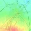
Socond topographic map

Click on the map to display elevation.

About this map

Name: Socond topographic map, elevation, terrain.

Location: Socond, Satu Mare, Romania (47.48344 22.90389 47.58818 23.05307)

Average elevation: 735 ft

Minimum elevation: 463 ft

Maximum elevation: 1,224 ft

Other topographic maps

Click on a map to view its topography, its elevation and its terrain.

Corund

Romania > Satu Mare

Average elevation: 689 ft

Lelei

Romania > Satu Mare

Average elevation: 827 ft

Carei

Romania > Satu Mare

Average elevation: 446 ft

Petea

Romania > Satu Mare

Average elevation: 397 ft

Giurtelecu Hododului

Romania > Satu Mare

Average elevation: 784 ft

Cean

Romania > Satu Mare

Average elevation: 610 ft

Sătmărel

Romania > Satu Mare > Satu Mare

Average elevation: 397 ft

Decebal

Romania > Satu Mare

Average elevation: 394 ft

Gear up for your next adventure:

📷Action Cameras - Rugged cameras to document your journeys across rugged terrain
🗃️Trail First Aid Kit - Essential kit for outdoor injuries and emergencies
🔥Plasma Lighters - Windproof lighters that work in any weather condition
🍳Camping Cook Set - Complete cookware for outdoor meals
⌚GPS Sports Watch - GPS watch for running, hiking and training

As an Amazon Associate, this site earns from qualifying purchases at no extra cost to you.