Geolocate

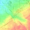
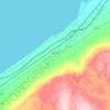
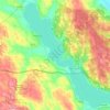
Elm Tree topographic map

Click on the map to display elevation.

About this map

Name: Elm Tree topographic map, elevation, terrain.

Location: Elm Tree, Town of North Harmony, Chautauqua County, New York, 14785, United States (42.13589 -79.49394 42.17589 -79.45394)

Average elevation: 1,549 ft

Minimum elevation: 1,358 ft

Maximum elevation: 1,726 ft

Chautauqua County trails, hiking, mountain biking, running and outdoor activities

Other topographic maps

Click on a map to view its topography, its elevation and its terrain.
Jamestown

United States > New York > Chautauqua County

Average elevation: 1,421 ft

Town of Ripley

United States > New York > Chautauqua County

Average elevation: 1,066 ft

Kennedy

United States > New York > Chautauqua County

Average elevation: 1,404 ft

Town of Clymer

United States > New York > Chautauqua County

Average elevation: 1,601 ft

Frewsburg

United States > New York > Chautauqua County > Frewsburg

Average elevation: 1,312 ft

Town of Busti

United States > New York > Chautauqua County

Average elevation: 1,470 ft

Town of Pomfret

United States > New York > Chautauqua County

Average elevation: 1,014 ft

Chautauqua Lake

United States > New York > Chautauqua County > Town of Chautauqua

Chautauqua Lake, at an elevation of 1,308 feet (399 m) above sea level, is higher than any of the Finger Lakes. It is also one of the highest navigable lakes in North America. The lake's water level is regulated by Warner Dam, with the water level lifted during the summer to allow for recreational boat use and…

Average elevation: 1,519 ft

Town of Ellery

United States > New York > Chautauqua County

Average elevation: 1,499 ft

Town of Harmony

United States > New York > Chautauqua County

Average elevation: 1,588 ft

Town of Ripley

United States > New York > Chautauqua County

Average elevation: 1,066 ft

Village of Cassadaga

United States > New York > Chautauqua County > Town of Stockton

Cassadaga is located on the northwestern edge of the Allegheny Plateau in western New York at 42°20'29" north, 79°18'56" west (42.341343, -79.315653) at an elevation of approximately 1,340 feet (410 m) above sea level. The village is located at the south end of Lower Cassadaga Lake, Lily Dale being located…

Average elevation: 1,371 ft
Town of Clymer

United States > New York > Chautauqua County

Average elevation: 1,601 ft

Jamestown

United States > New York > Chautauqua County

Average elevation: 1,421 ft

Gear up for your next adventure:

🪶Wildlife Field Guides - Learn animal tracking and species ID
📱Heavy-Duty Phone Cases - Drop-proof and waterproof protection for outdoor navigation
🎒Waterproof Dry Bags - Keep your electronics and maps dry inside your pack
📱Solar Portable Charger - Solar power bank for charging devices off‑grid
🎒Trail Energy Bars - High‑calorie bars for hiking energy

As an Amazon Associate, this site earns from qualifying purchases at no extra cost to you.