Geolocate

Sweet Home topographic map

Click on the map to display elevation.

About this map

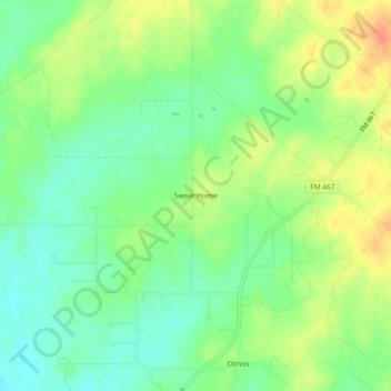
Name: Sweet Home topographic map, elevation, terrain.

Location: Sweet Home, Guadalupe County, Texas, United States (29.43801 -98.05890 29.47801 -98.01890)

Average elevation: 545 ft

Minimum elevation: 482 ft

Maximum elevation: 627 ft

Guadalupe County trails, hiking, mountain biking, running and outdoor activities

Other topographic maps

Click on a map to view its topography, its elevation and its terrain.

Santa Clara

United States > Texas > Guadalupe County

Average elevation: 719 ft

New Berlin

United States > Texas > Guadalupe County

Average elevation: 558 ft

Marion

United States > Texas > Guadalupe County

Average elevation: 640 ft

Kingsbury

United States > Texas > Guadalupe County > Kingsbury

Average elevation: 545 ft

Gear up for your next adventure:

🏕️Tent Footprint - Protect your tent base from wear
🧴Hand Sanitizer - Keep hands clean while hiking
🧣Merino Neck Gaiters - Multi-functional headwear for wind and sun protection
🪶Thermal Camp Blanket - Extra warmth for cold nights
📷Action Camera - Capture your outdoor adventures in HD

As an Amazon Associate, this site earns from qualifying purchases at no extra cost to you.