
Make a donation
Gear up for your next adventure:
As an Amazon Associate, this site earns from qualifying purchases at no extra cost to you.
Prieros topographic map
Click on the map to display elevation.
Make a donation
Gear up for your next adventure:
As an Amazon Associate, this site earns from qualifying purchases at no extra cost to you.
About this map
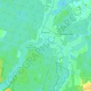
Name: Prieros topographic map, elevation, terrain.
Location: Prieros, Heidesee, Dahme-Spreewald, Brandenburg, Deutschland (52.19647 13.75856 52.23900 13.80283)
Average elevation: 128 ft
Minimum elevation: 105 ft
Maximum elevation: 194 ft
Make a donation
Gear up for your next adventure:
As an Amazon Associate, this site earns from qualifying purchases at no extra cost to you.
Other topographic maps
Click on a map to view its topography, its elevation and its terrain.
Schloß Neuhaus
Deutschland > Brandenburg > Dahme-Spreewald > Lübben (Spreewald) > Steinkirchen
Das Bauwerk wurde 1801 als eingeschossiger verputzter Bau im Biedermeierstil an der Stelle eines Vorgängergebäudes errichtet und steht auf einem hohen Sockelgeschoss. Die Fassade gliedert sich in einen Mittelrisalit und Seitenrisalite. Zur Gartenseite besteht ein Portikus, zur Hofseite gibt es einen Balkon…
Average elevation: 177 ft
Dammer Teich
Deutschland > Brandenburg > Dahme-Spreewald > Lieberose > Damme
Average elevation: 171 ft
Make a donation
Gear up for your next adventure:
As an Amazon Associate, this site earns from qualifying purchases at no extra cost to you.
Make a donation
Gear up for your next adventure:
As an Amazon Associate, this site earns from qualifying purchases at no extra cost to you.
Make a donation
Gear up for your next adventure:
As an Amazon Associate, this site earns from qualifying purchases at no extra cost to you.
Zauche
Deutschland > Brandenburg > Dahme-Spreewald
Zauche gehörte zur Herrschaft Golßen. Diese wechselte im Laufe der Zeit mehrfach den Besitzer und stand ab Mitte des 19. Jahrhunderts unter der Grundherrschaft des Adelsgeschlechtes Solms-Baruth. Laut der Topographisch-statistischen Übersicht des Regierungsbezirks Frankfurt an der Oder aus dem Jahr 1844…
Average elevation: 207 ft
Make a donation
Gear up for your next adventure:
As an Amazon Associate, this site earns from qualifying purchases at no extra cost to you.
Drachenberge
Deutschland > Brandenburg > Dahme-Spreewald > Königs Wusterhausen
Average elevation: 138 ft
Make a donation
Gear up for your next adventure:
As an Amazon Associate, this site earns from qualifying purchases at no extra cost to you.
Mittenwalde
Deutschland > Brandenburg > Dahme-Spreewald > Mittenwalde > Mittenwalde
Average elevation: 141 ft
Königs Wusterhausen
Deutschland > Brandenburg > Dahme-Spreewald > Königs Wusterhausen > Königs Wusterhausen
Königs Wusterhausen liegt in den Niederungen zwischen den Höhenzügen des Teltow und der Beeskower Platte, dem Dahmeland. Dabei durchzieht die kulturlandschaftliche Grenze des Teltow die Stadt von Süden nach Norden. Entsprechend war die Gegend um die Stadt sehr durch Moore bzw. Moorwiesen geprägt.
Average elevation: 144 ft