Geolocate

Deep Bay topographic map

Interactive map

Click on the map to display elevation.

About this map

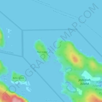
Name: Deep Bay topographic map, elevation, terrain.

Location: Deep Bay, Area E (Lasqueti Island), qathet Regional District, British Columbia, Canada (49.50377 -124.22162 49.51015 -124.21254)

Average elevation: 43 ft

Minimum elevation: -3 ft

Maximum elevation: 427 ft

Other topographic maps

Click on a map to view its topography, its elevation and its terrain.

Lasqueti Island

Canada > British Columbia > qathet Regional District > Area E (Lasqueti Island)

Lasqueti Island, Area E (Lasqueti Island), qathet Regional District, British Columbia, V0R 2J0, Canada

Average elevation: 171 ft

Lasqueti

Canada > British Columbia > qathet Regional District > Area E (Lasqueti Island) > Lasqueti

Lasqueti, Area E (Lasqueti Island), qathet Regional District, British Columbia, V0R 2J0, Canada

Average elevation: 157 ft