
Grapevine topographic map
Click on the map to display elevation.
About this map
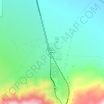
Name: Grapevine topographic map, elevation, terrain.
Location: Grapevine, Kern County, California, United States (34.92164 -118.95010 34.96164 -118.91010)
Average elevation: 1,644 ft
Minimum elevation: 1,234 ft
Maximum elevation: 2,746 ft
Kern County trails, hiking, mountain biking, running and outdoor activities
Other topographic maps
Click on a map to view its topography, its elevation and its terrain.
Kernville
United States > California > Kern County > Kernville
Kernville is a census-designated place (CDP) in the southern Sierra Nevada, in Kern County, California, United States. Kernville is located 42 miles (68 km) northeast of Bakersfield, at an elevation of 2,667 feet (813 m). The population was 1,549 at the 2020 United States census, up from 1,395 at the 2010…
Average elevation: 3,724 ft
Ford City
United States > California > Kern County > Taft
Ford City is a census-designated place (CDP) in Kern County, California, United States. Ford City is located 1 mile (1.61 km) north of Taft, at an elevation of 892 feet (272 m). The population was 4,348 at the 2020 census, up from 4,278 at the 2010 census. It is immediately north of Taft, between the huge…
Average elevation: 866 ft
South Taft
United States > California > Kern County > Taft > South Taft
South Taft is a census-designated place (CDP) in Kern County, California, United States. South Taft is located 0.5 miles (0.8 km) south of Taft, at an elevation of 1,017 feet (310 m). The population was 2,169 at the 2010 census, up from 1,898 at the time of the 2000 census.
Average elevation: 1,125 ft
Fellows
United States > California > Kern County
Fellows is a census-designated place (CDP) in Kern County, California, United States. Fellows is located 5 miles (8 km) west-northwest of Taft, at an elevation of 1,316 feet (401 m). The population was 106 at the 2010 census, down from 153 at the 2000 census. Fellows is surrounded on all sides by the enormous…
Average elevation: 1,378 ft
Weedpatch
United States > California > Kern County
The community, which lies at an elevation of 387 feet (118 m), is situated off State Route 184 (Weedpatch Highway) southeast of Bakersfield, south of Lamont and about 5 miles (8 km) south of State Route 58. It is at 35°14′17″N 118°54′54″W / 35.23806°N 118.91500°W / 35.23806; -118.91500.…
Average elevation: 384 ft
Inyokern
United States > California > Kern County
Inyokern (formerly Siding 16 and Magnolia) is a census-designated place (CDP) in Kern County, California, United States. Its name derives from its location near the border between Inyo and Kern Counties. Inyokern is located 8 miles (13 km) west of Ridgecrest, at an elevation of 2,434 feet (742 m). It is on the…
Average elevation: 2,470 ft
Wofford Heights
United States > California > Kern County
Wofford Heights is a census-designated place (CDP) in the southern Sierra Nevada, in Kern County, California, United States. Wofford Heights is located in the west Kern River Valley, 3.5 miles (5.6 km) south-southwest of Kernville, at an elevation of 2,684 feet (818 m). The population was 2,200 at the 2010…
Average elevation: 3,655 ft
Taft Heights
United States > California > Kern County > Taft > Taft Heights
Taft Heights (formerly, Boust City) is a census-designated place (CDP) in Kern County, California, United States. Taft Heights is located 1 mile (1.6 km) west-southwest of Taft, at an elevation of 1,178 feet (359 m). The population was 1,949 at the 2010 census, up from 1,865 at the 2000 census.
Average elevation: 1,207 ft
Oildale
United States > California > Kern County
Oildale is a census-designated place (CDP) in Kern County, California, United States. Oildale is located 3.5 miles (5.6 km) north-northwest of downtown Bakersfield, at an elevation of 469 feet (143 m). The population was 32,684 at the 2010 census, up from 27,885 at the 2000 census. It is an unincorporated…
Average elevation: 538 ft
Lost Hills
United States > California > Kern County
Lost Hills (formerly, Lost Hill) is a census-designated place (CDP) in Kern County, California, United States. Lost Hills is located 42 miles (68 km) west-northwest of Bakersfield, at an elevation of 305 feet (93 m). The population was 2,412 at the 2010 census, up from 1,938 at the 2000 census. About 75% of…
Average elevation: 269 ft
Weldon
United States > California > Kern County
Weldon is a census-designated place (CDP) in Kern County, California, United States. It sits at the southeast tip of Lake Isabella. Weldon is located 9 miles (14 km) east-southeast of Wofford Heights, at an elevation of 2,654 feet (809 m). The population was 2,642 at the 2010 census, up from 2,387 at the 2000…
Average elevation: 3,379 ft
Maricopa
United States > California > Kern County
Maricopa is a city in Kern County, California. Maricopa is located 6.5 miles (10 km) south-southeast of Taft, at an elevation of 883 feet (269 m). The population was 1,154 at the 2010 census, up from 1,111 at the 2000 census. The Carrizo Plain is located to the northwest, and the enormous Midway-Sunset Oil…
Average elevation: 912 ft