
Taylor Mill topographic map
Click on the map to display elevation.
About this map
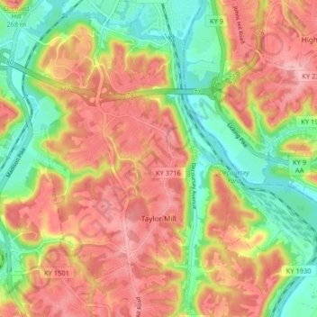
Name: Taylor Mill topographic map, elevation, terrain.
Location: Taylor Mill, Kenton County, Kentucky, 41015, United States (38.97794 -84.52537 39.04084 -84.45057)
Average elevation: 692 ft
Minimum elevation: 453 ft
Maximum elevation: 909 ft
Kenton County trails, hiking, mountain biking, running and outdoor activities
Other topographic maps
Click on a map to view its topography, its elevation and its terrain.
Daniel Carter Beard Boyhood Home
United States > Kentucky > Kenton County > Covington
Average elevation: 515 ft