Geolocate

Qualicum Beach topographic map

Click on the map to display elevation.

About this map

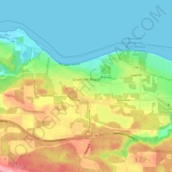
Name: Qualicum Beach topographic map, elevation, terrain.

Location: Qualicum Beach, Regional District of Nanaimo, British Columbia, Canada (49.32648 -124.48699 49.36384 -124.37902)

Average elevation: 167 ft

Minimum elevation: 0 ft

Maximum elevation: 459 ft

Other topographic maps

Click on a map to view its topography, its elevation and its terrain.

Gear up for your next adventure:

💧Water Filtration Bottles - Safely drink from streams and lakes while exploring
🪶Survival Guide Book - Expert advice for emergency preparedness
🪄Magnetic Compass - Accurate compass for navigation
🧣Hiking Neck Gaiter - Multi‑use neck protection for outdoor weather
🔌USB Car Charger - Car charger for on‑the‑go power needs

As an Amazon Associate, this site earns from qualifying purchases at no extra cost to you.